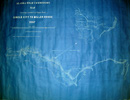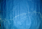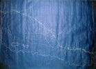
This collection of four maps donated by Frank and Mary Warren was prepared
by H.H. Edgerton, the army engineer
in charge of surveying the wagon road from Circle City to Miller House.
This allignment bypassed Twelvemile House
and resulted in the roadhouse and ferry (re-christened Ferry Ranch by the
Rieger's who purchased Twelvemile House
in 1906) being rebuilt in the current location where the Steese Highway
crosses Birch Creek. There were 8 maps in
the set. This collection contains the maps from Circle City to Albert Creek.
The small map in the upper-right corner of
the map from Circle City to 6.5 mile shows the proposed allignment prior
to the decision to bypass Twelvemile House.


